Less Visited Sites
The Adventurous Life list covers less visited but equally extraordinary geologic sites in the National Parks. These far-flung destinations will take you off the beaten path to parks with spectacular examples of dune systems, columnar basalts, monoclines, crustal breaks, and more.

NPS Photo/Ike Fitz.
Aniakchak National Monument, Alaska
Aniakchak is located on the Alaska Peninsula, part of the Aleutian volcanic arc. The Aniakchak caldera is one of the youngest calderas in North America, erupting last in 1931 and is one of the finest examples of a dry caldera in the world. The Aleutian arc itself is one of the simplest and most visible subduction zones on Earth.
[Geodiversity Atlas] [Park Home]

USGS Photo by Kenzie J. Turner.
Big Bend National Park, Texas
Contains a well preserved and clearly exposed section of rock spanning the K-T boundary, also referred to as the Cretaceous-Paleogene (K-Pg) boundary. Approximately sixty-five million years ago the Cretaceous time period came to a close and the Tertiary time period began. This transition, known as the K-Pg boundary, is visible in the geologic record and marks one of the greatest mass extinctions of all time, and the end of the dinosaurs. Big Bend has the southernmost known exposure of terrestrial sedimentary rocks recording the K-Pg boundary in the United States. Big Bend is also relatively close to the Yucatan meteor impact crater believed to be responsible for the K-Pg mass extinction.
[Geodiversity Atlas] [Park Home]
NPS Photo/Jack Wood.
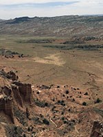
Capitol Reef National Park, Utah
Contains a classic and well exposed monocline, the Waterpocket Fold. This nearly 100-mile long warp in the Earth's crust has lifted the rock layers on the west side more than 7,000 feet higher than the layers on the east. This giant fold has been deeply eroded exposing over 10,000 feet of continuous sedimentary strata. The Waterpocket Fold formed between 50 and 70 million years ago during the Laramide Orogeny.
[Geodiversity Atlas] [Park Home]
USGS Photo.
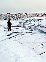
Denali National Park, Alaska
[Geodiversity Atlas] [Park Home]
NPS Photo
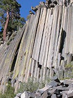
Devils Postpile National Monument, California
One of the world's finest examples of columnar basalt with continuous columns over 60 feet high. Uniform cooling conditions and homogeneity of the lava flows that filled the Middle Fork of the San Joaquin River to over 400 feet deep helped to form the almost perfectly hexagonal columns. Around 10,000 years ago, glaciers truncated and carved into the lava flow, exposing the interior. The Devil's Postpile is one of the prominent remnants of this glaciation.
[Geodiversity Atlas] [Park Home]
NPS Photo
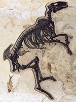
Fossil Butte National Monument, Wyoming
Includes some of the most nearly perfectly preserved fossils of ancient plant and animal life in the world. Within the world renowned Green River Formation, Fossil Butte contains one of the world's best collection of fossilized freshwater fish, hundreds of insect species, uncounted plant species, and various other organisms such as bats, birds, turtles, and crocodiles. Fossil Butte originated as Fossil Lake, in which the constant precipitation of calcium carbonate helped to preserve the organisms which fell to the bottom of the lake.
[Geodiversity Atlas] [Park Home]

NPS Photo
Great Sand Dunes National Park and Preserve, Colorado
Houses the tallest sand dunes, over 750 feet, in North America and one of the most fragile and complex dune systems in the world. Sand and sediments deposited in the San Luis Valley were picked up by the fierce winds blowing towards the Northeast. The sands were deposited at the base at the Sangre de Cristo Mountains, which barred their passage, creating the enormous dunes in the high mountainous setting.
[Geodiversity Atlas] [Park Home]
NPS Photo
Guadalupe Mountains National Park, Texas
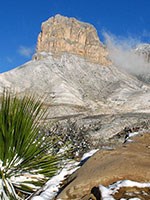
Contains one of the Earth's finest examples of an ancient marine fossil reef. The 400 mile long Permian Capitan Reef, composed of the resistant Capitan Limestone, is well exposed in the Guadalupe Mountains. Guadalupe Mountains National Park is a must see for petroleum geologists interested in understanding reef systems.
[Geodiversity Atlas] [Park Home]

NPS Photo
Olympic National Park, Washington
Surprisingly, one of the wettest parts of the country also contains one of the most dramatic rain shadows in the United States. Moisture is released from the air as it passes over the Olympic Mountains. Mount Olympus receives around 200 inches of precipitation a year, while the small town of Sequim on the northeastern corner of the Olympic peninsula receives less than twenty.
[Geodiversity Atlas] [Park Home]
NPS Photo
Padre Island National Seashore, Texas
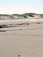
North Padre Island is the longest undeveloped barrier island in the world. The National Seashore is 70 miles long with 65.5 miles of Gulf beach. The constant interplay between the wind, ocean, rivers, tides, and storms make barrier islands one of the most dynamic earth systems. The Park hosts a variety of pristine beach, dune, and tidal flat environments.
[Geodiversity Atlas] [Park Home]

NPS Photo
Virgin Islands National Park, Virgin Islands
The small island of St. John contains beautiful examples of coral reefs, white coral sand, and coral rubble beaches. There are excellent examples for each coral reef zone including striking reef flats and algal ridges.
[Geodiversity Atlas] [Park Home]
NPS Photo
Voyageurs National Park, Minnesota
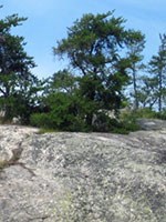
Voyageurs National Park, and Grand Teton National Park, Wyoming contain some of the oldest rocks in North America. Voyageurs, located in the southern portion of the Canadian Shield, displays rocks 2.6 - 2.85 billion years old. The oldest rocks in Grand Teton National Park are close to 2.7 billion years old and appear as complexly deformed metamorphic gneiss on Mt. Owen. The oldest rocks in America are located about 200 miles southwest of Voyagers and are up to 3.6 billion years old.
[Geodiversity Atlas] [Park Home]
NPS Photo
White Sands National Monument, New Mexico
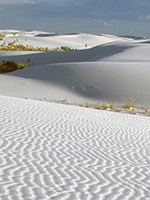
Great wave-like gypsum sand dunes engulf over 275 square miles of desert and have created the world's largest gypsum dune field. Rain and snow melt flows from the surrounding mountains into the closed Tularosa Basin. Water pools in various playas and evaporates slowly causing gypsum to be deposited in a crystalline form called selenite. The forces of nature (freezing and thawing, wetting and drying) eventually break down the crystals into sand-size particles light enough to be moved by the wind and deposited in the White Sands dune field.
[Geodiversity Atlas] [Park Home]

Photo courtesy of Ken Redeker.
White Sands National Monument, New Mexico
Contains one of the few examples of yardangs in the United States. Yardangs are streamlined, wind-eroded ridges found in arid regions. The White Sands' yardangs are well developed and impressive in size. The elongate yardangs form in the lightly cemented gypsum sand and are eroded by the prevailing southwest to northeast winds.
[Geodiversity Atlas] [Park Home]
Explore more of America's geologic heritage
A Full Life | An Adventurous Life | An Extreme Life | Find Your Park
Last updated: June 14, 2018
