Last updated: November 22, 2023
Thing to Do
Saddle Rock Trail Geology Hiking Tour
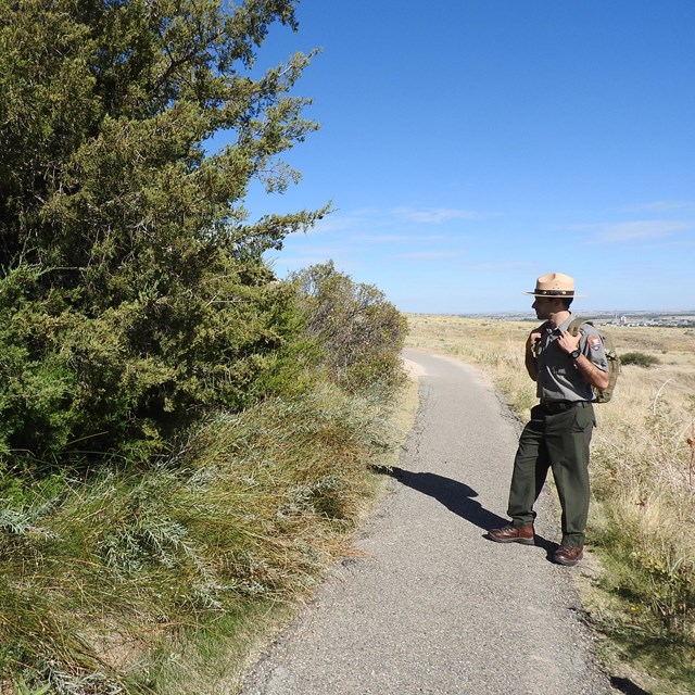
NPS/Eric Grunwald
Are you fascinated by rocks and geology? Learn more about the geological forces that shaped, and continue to shape Scotts Bluff on this 1.6 mile hike!
Details
Duration
60-90 Minutes
Activity
Self-Guided Tours - Walking
On this self-guided walking tour of the Saddle Rock Trail, visitors will have an opportunity to observe and learn about some of the unique geology of Scotts Bluff National Monument. The Saddle Rock Trail is a 1.6 mile-long trail with 435 feet of elevation change.
Pets Allowed
Yes
Activity Fee
No
Entrance fees may apply, see Fees & Passes information.
Location
North Overlook Trailhead
The Saddle Rock Trail Self-Guided Geology Tour starts at the Summit of Scotts Bluff. When the Summit Road is open to vehicular traffic, participants should drive to the Summit Parking Area. At the Summit Parking Area, walk the North Overlook Trail to the far end where the tour starts at a scenic overlook of the North Platte RIver Valley and the Orella badlands below.
Participants may also start their tour at the Lower Saddle Rock Trailhead and hike up and down the trail for a 3.2 mile round-trip hike. Another option is to take the Summit Shuttle to the Summit of Scotts Bluff when it is available.
Participants may also start their tour at the Lower Saddle Rock Trailhead and hike up and down the trail for a 3.2 mile round-trip hike. Another option is to take the Summit Shuttle to the Summit of Scotts Bluff when it is available.
Reservations
No
Season
Year Round
The Saddle Rock Trail is open year-round. However, snow and ice may make sections of the trail slippery and dangerous.
Time of Day
Day
Scotts Bluff National Monument's grounds and trails are open sunrise to sunset.
Accessibility Information
Access to the North Overlook is by a 16% uphill path of about 60 yards (55 meters). The path is paved and approximately 36 inches wide. It will take you to a level looping trail system which is about 150 yard (137 meters) long. Several overlooks from the summit will reveal the North Platte Valley. The remaining 100 yards (91 meters) contains a steep downhill grade of 19% with dropoffs on either side.

NPS/Eric Grunwald
This is a 1.6 mile (one-way) hike along the Saddle Rock Trail. The self-guided tour is set up to begin at the summit of Scotts Bluff. However, you can also begin at the lower trailhead which is located just east of the visitor center. There is an elevation change of 435 feet on this trail and no water is available along the trail. To get to the first stop, drive to the summit of Scotts Bluff and take the North Overlook Trail to the northmost overlook. There you will see a view that reaches across the North Platte River Valley.
-
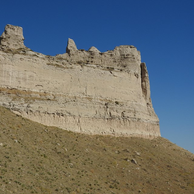
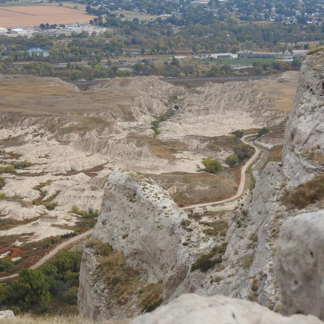 Stop 1: Orella Badlands from Overlook
The northernmost end of the North Overlook Trail offers a wonderful view of the Orella Badlands and North Platte River below.
-
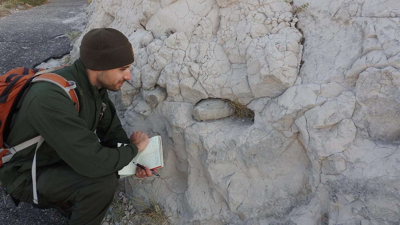
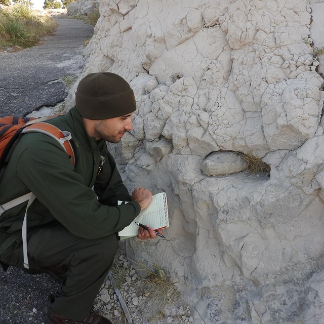 Stop 2: "Pipy" Concretions
Pipy concretions of limestone act like a caprock and protect the layers of softer rock below them,
-
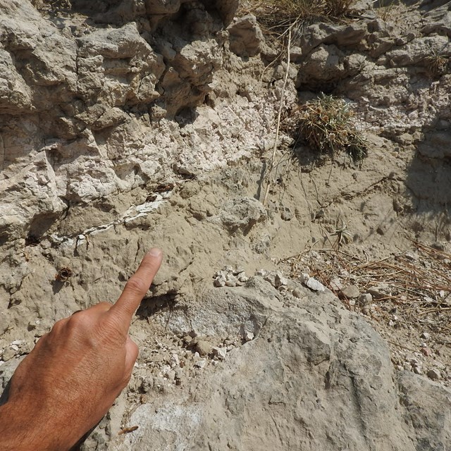 Stop 3: Ash Lens
An ash lentil or lens is body of ash that is thick in the middle and thin at the edges, resembling a convex lens in cross-section.
-
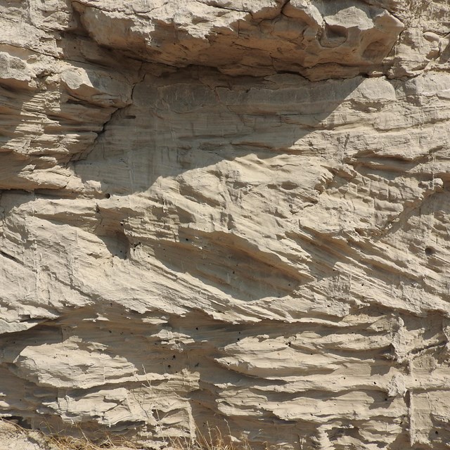 Stop 4: Cross-stratified sand
The sandstone along this cliff face is cross-stratified or cross-bedded.
-
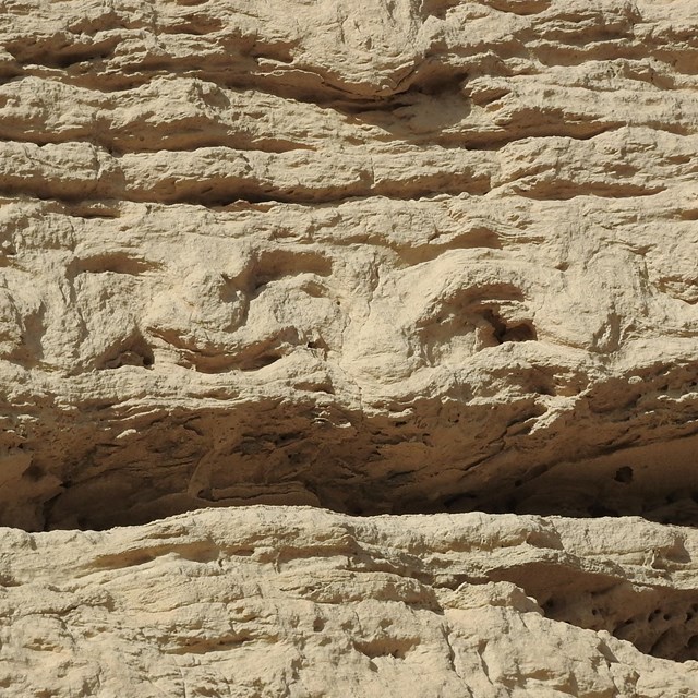
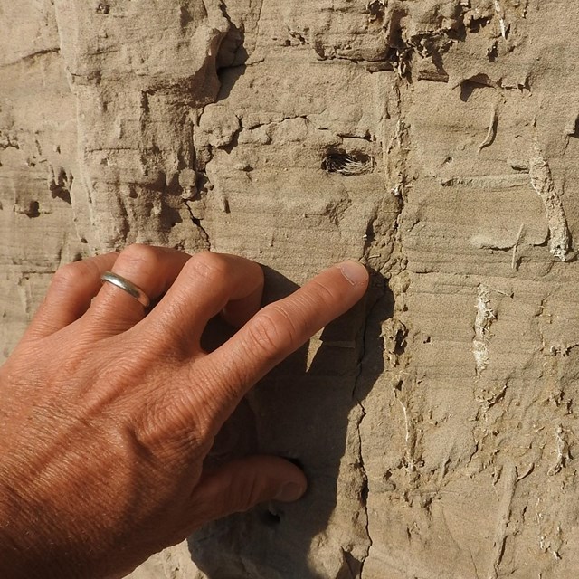 Stop 5: Invertebrate Burrows
Excellent samples of a number of different types of invertebrate burrows are present in the ash and in adjacent sandstones.
-
 Stop 6: Massive Sandstone
Sandstone in this location is massive, meaning it lacks obvious layering.
-
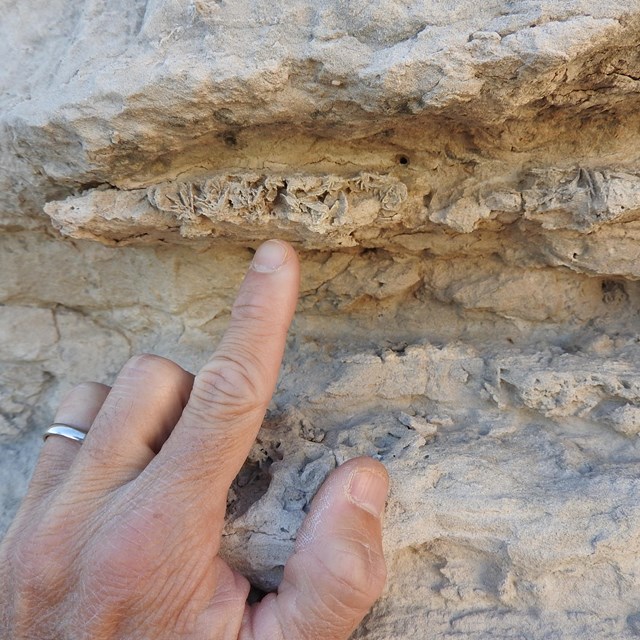 Stop 7: Calcite Sand Crystals
Sand crystals were formed through calcite replacement of gypsum.
-
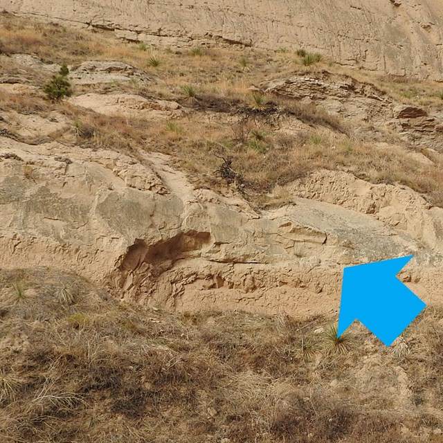
 Stop 8: Vertebrate Tracks
Concave-up deformation structures that scientists interpret as vertebrate tracks are seen here.
-
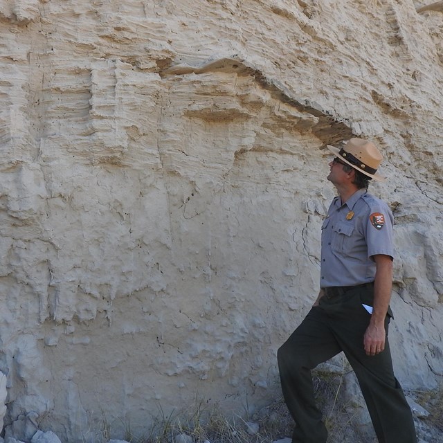
 Stop 9: The Whitney-Gering Contact
30 feet above the trail, the Gering Formation ends and the Whitney Member of the Brule Formation begins.
-
 Stop 10: Rockfall
Just below Saddle Rock are the remains of a large rockfall that happened in 1974.
-
 Stop 11: Scotts Spring
Scotts Spring is the only natural spring located in Scotts Bluff National Monument and issues from cracks within Whitney Member siltstones.