|
Capitol Reef
Cultural Landscape Report |

|
ANALYSIS AND EVALUATION (continued)
VEGETATION RELATED TO LAND USE (continued)
(Orchard Summaries)
Current Name: Merin Smith Place
Other Name(s): South Smith Place
Park Code: 0-07
Location: Approximately .9 miles from visitor center on the south side of State Highway 24.
Tract: 7
Acres Cultivated:
| Orchard | 1.4 |
| Field | 2.1 |
| Total | 3.5 |
Number of Trees: 49
Date Recorded: March 1993
| |
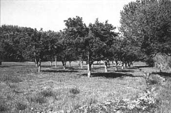
| Merin Smith Place | |
Historical Documentation:
This orchard was originally part of the Nels Johnson homestead of 160 acres. It was owned by Amasa Pierce, 'Tine Oyler, and M. E. and Jehu Blackburn prior to its ownership by Merin and Cora Smith (1928-1961). In 1940 there were approximately 5.2 acres farmed, with 3.2 acres in orchard and 2.0 acres in field. In 1962, 1.1 acres were lost to construction of State Highway 24; .6 acres were abandoned.
Historic Crops:
Pear (39)
Apricot (29)
Apple (26)
Cherry (16)
Peach (14)
Current Crops:
(west side of house site)
Apple
Apricot
Pear
(east side of house site)
Cherry (pie)
Pear
Bartlett
Plum
| <<< Previous | <<< Contents >>> | Next >>> |
http://www.nps.gov/care/clr/clr4d5.htm
Last Updated: 01-Apr-2003