Fort Vancouver
Cultural Landscape Report
|

|
IV. FORT VANCOUVER: VANCOUVER BARRACKS, 1861-1918

|
|
(click on image for an enlargement in a new window)
|

|
|
Map 18. Vancouver Barracks, Wash., 1914.
Drawn by C.H. STone, Office of the Const. Quartermaster, Vancouver Barracks.
Shows results of early 20th century development at Vancouver Barracks and
the rail spur onto the site from the Spokane, Portland and Seattle Railway.
|
|
|
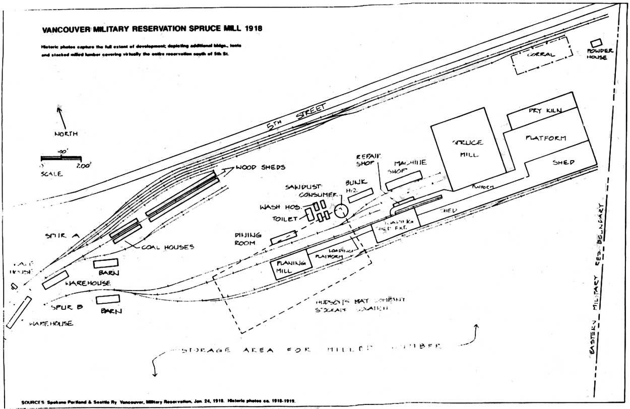
Map 19. Vancouver Military
Reservation, Spruce Mill, 1918. The structures associated with the
Spruce Division included tents and temporary buildings not shown on this
map. Compare with Figure 20. By Terri Taylor, National Park
Service, Pacific Northwest Region. (click on image for an
enlargement in a new window).
|
fova/clr/clr2-4c1.htm
Last Updated: 27-Oct-2003
|